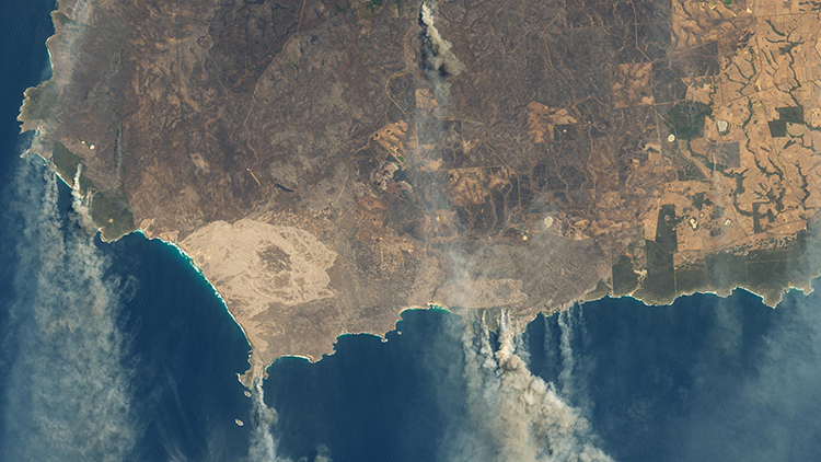
Bushfires are common in northern Australia. (The scrub, woodland, and grasslands of Australia and New Zealand are called “the bush.”) The winters are dry, and a lightning strike or human error can ignite a blaze. Usually, these fires can be contained. This fire season is different, though. Large areas of Australia have been engulfed in flames since late July 2019, with some of the worst bushfires that have erupted in decades.
What has caused these fires to be so devastating and widespread? Experts believe that climate change has created extreme weather conditions. Australia is experiencing one of its worst droughts ever amid record-high temperatures. Strong winds fan and spread the flames. This means fires started earlier in the fire season and spread with more intensity. The strong winds also make firefighting very dangerous.
How have these fires affected the continent? Fires have burned in every state in Australia, tearing through the bushland, the woods, and national parks. Air quality [how much pollution is in the air] is compromised. In Sydney, the air quality measured 11 times the hazardous level. While some of the fires are small, others are massive—so large they can be seen from space. Some of these infernos have been burning for months. Many people across Australia have lost their homes. Ecologists believe that it’s possible that one billion animals have died in the flames. Not only have animals died, but their habitats have been destroyed.
Many have pitched in to fight these fires, with the United States, Canada, and New Zealand sending help to Australia. When will these fires end? No one knows for sure. Temperatures in Australia usually peak in January and February, so it may be months before the fires are over. In the past weeks, rains have poured on Australia. This sounds like good news, but downpours bring worries of flash floods over lands that are bare after fires.
What Do You Think? What do you think are the worst effects of the fires in Australia? What could you do to help?
Photo Credit: NASA Earth Observatory images by Lauren Dauphin, using Landsat data from the U.S. Geological Survey.


